I made it up! Running up Barr Trail was definitely an amazing experience, and something I want to do again, and wanted to repeat before I even finished it the first time. The quick stats:
- Total time: 4:26:28
- Distance: 11.32 miles (avg 23:31/mile)
- Elevation gain: 7382ft
Here are some pictures that I took on the way – note most are a little blurry/washed out because my phone was in a plastic bag the whole time to protect it from sweat.
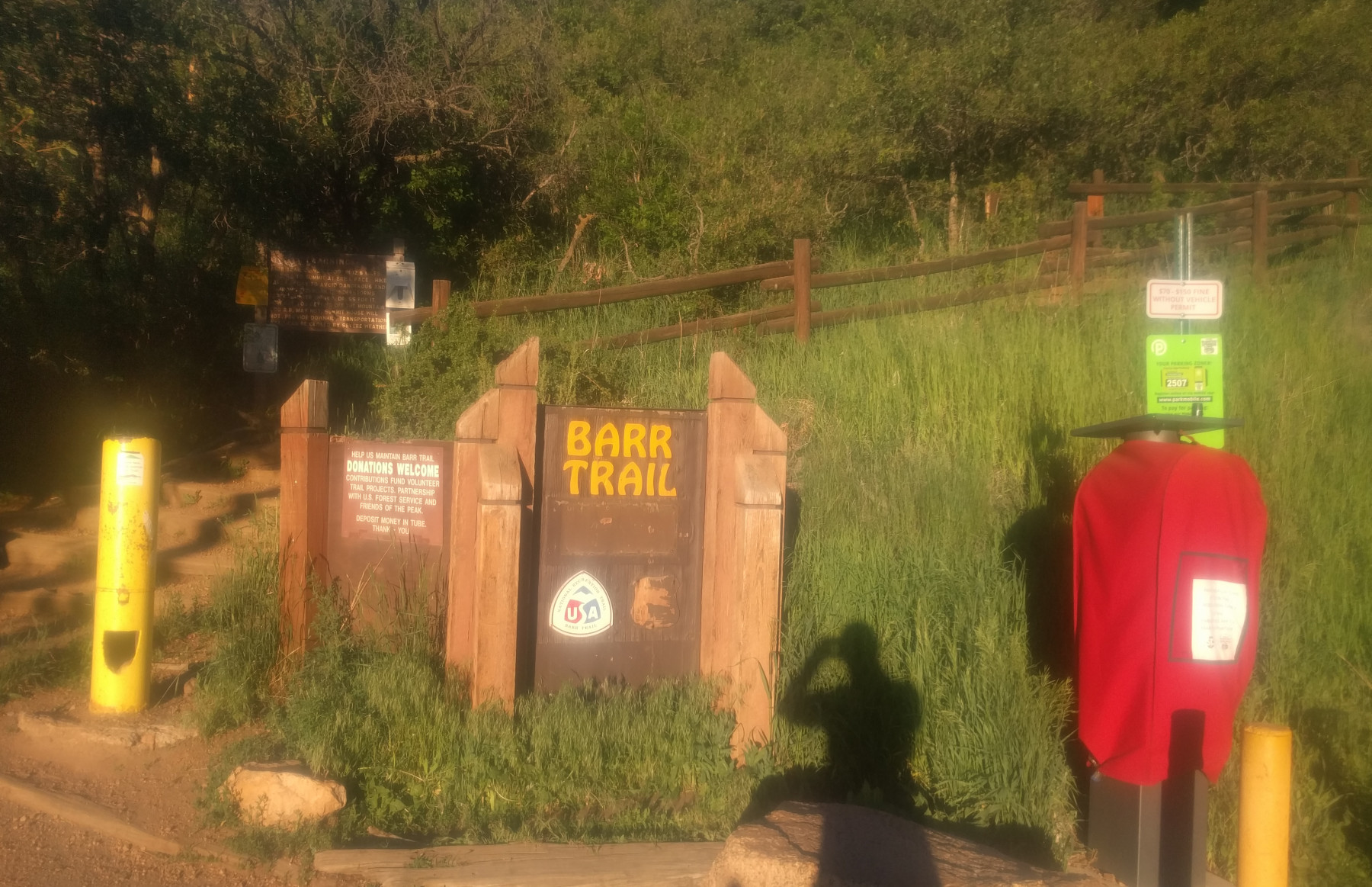
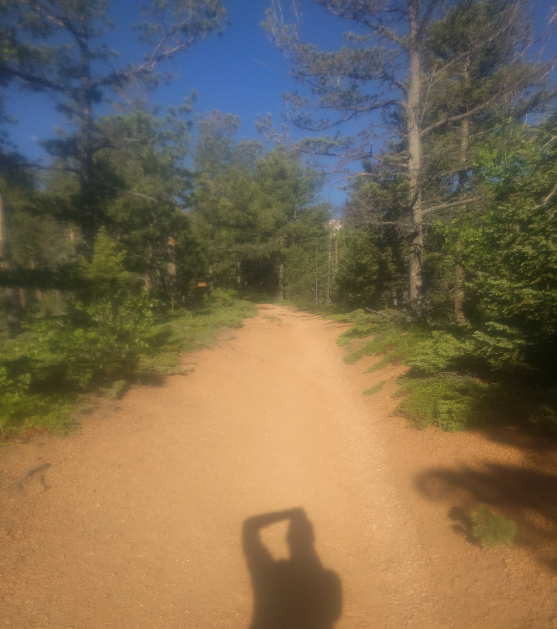
The trail head – a small parking lot off a small (but steep) street past the Cog Railway station. At this point (about 6:30am) it was about 3/4 full. A quick picture and I was on my way. The weather was beautiful for running, clear and about 60-65F, with highs climbing into the mid 70s (but only at the base, further up in altitude it got colder and the summit was in the 40s with a windchill in the 20s).
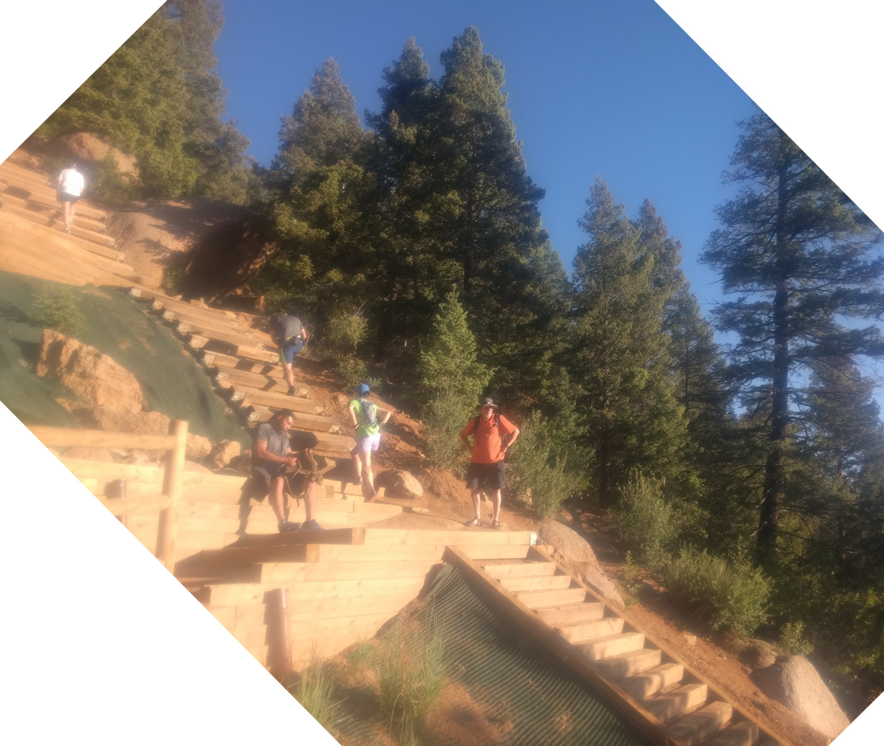
The Incline – a view of The Incline from Barr Trail, maybe 1.5 miles in. The Incline is a set of steep stairs about a mile in length with over 2000ft of climbing with connections to Barr Trail, it was pretty crowded even this early on a weekday – lots of people were running up the Incline and back down on Barr Trail. I’d like to try The Incline one day, but didn’t want to burn my legs out before climbing to the summit.
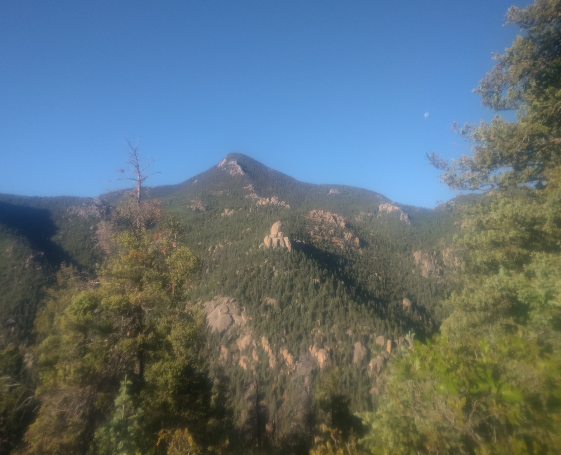
The W’s – The first section of Barr Trail is a number of steep switchbacks known as the W’s affording the runner quick gains in elevation and beautiful views of nearby peaks. I wanted to stop every switchback to take a picture. There were quite a few hikers going up, and a couple runners from the incline coming down. I took this first part fairly easy because after all I still had a mountain to climb. This view is off to the left where you can see 2 or 3 other smaller peaks.

The W’s – another view from the W’s, this time back down the trail and towards the town of Manitou Springs. All the pictures I took facing this way are washed out because the sun, but it was spectacular views and after only 10 or 20mins you really are much higher up than the town.
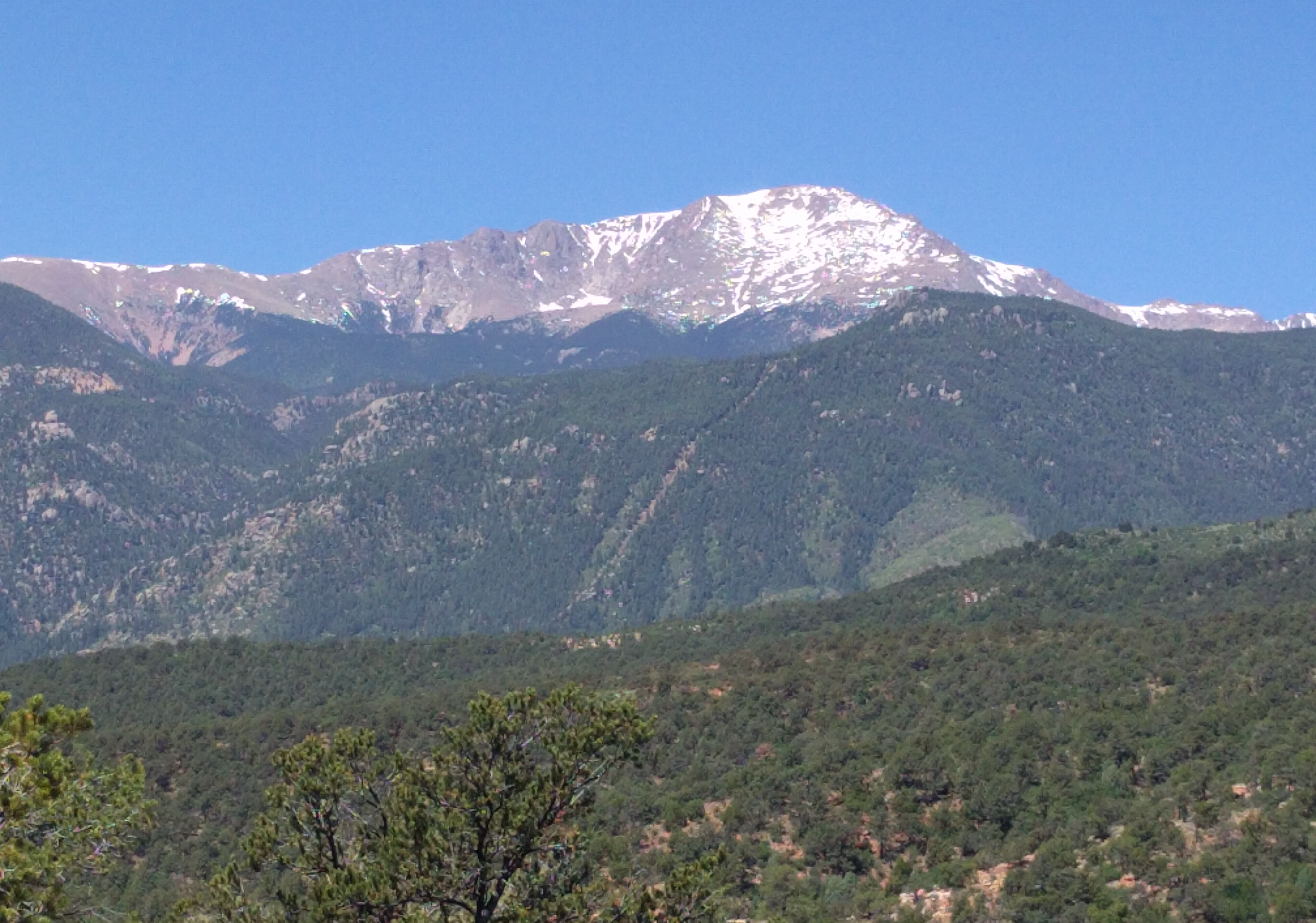
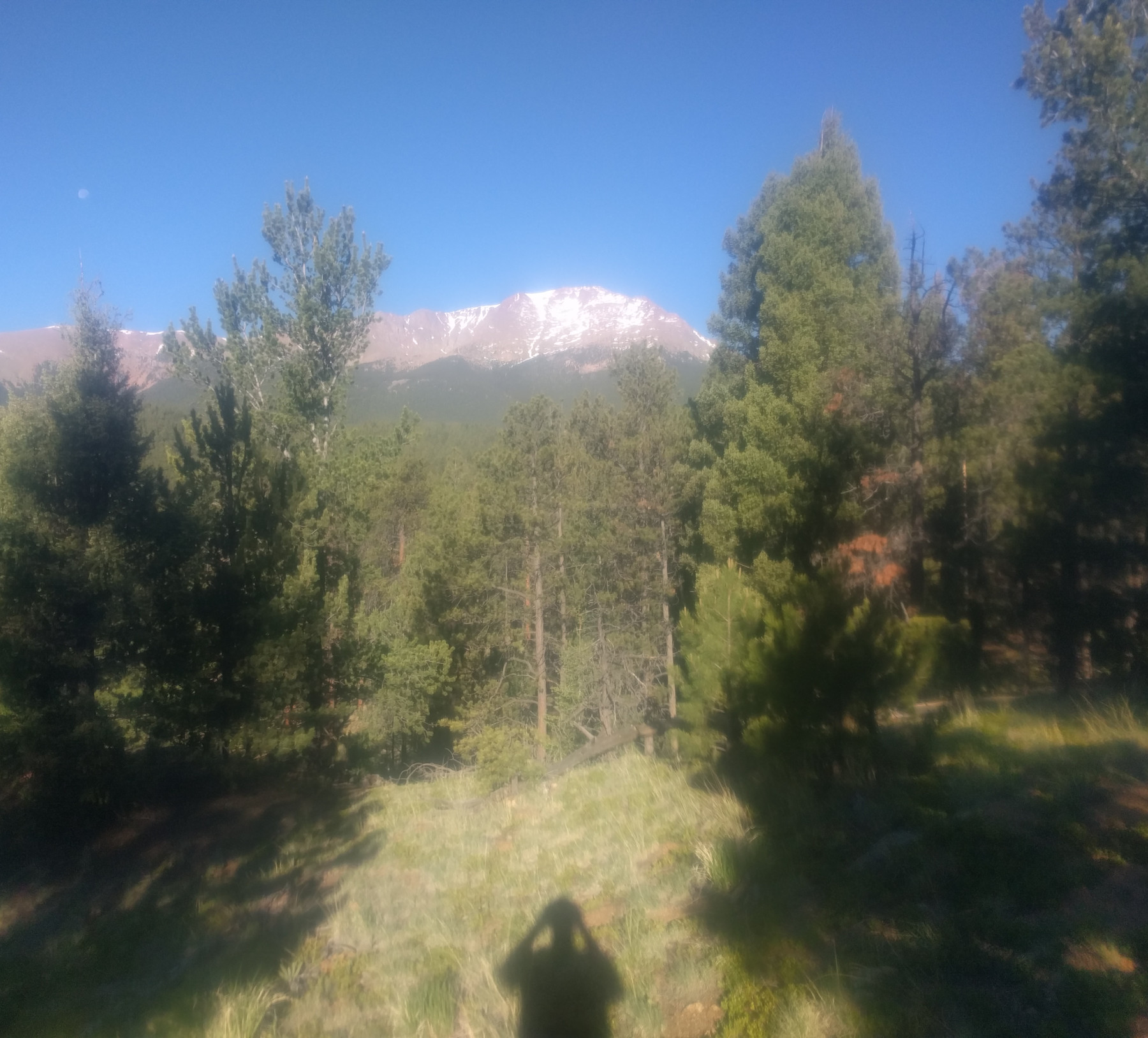
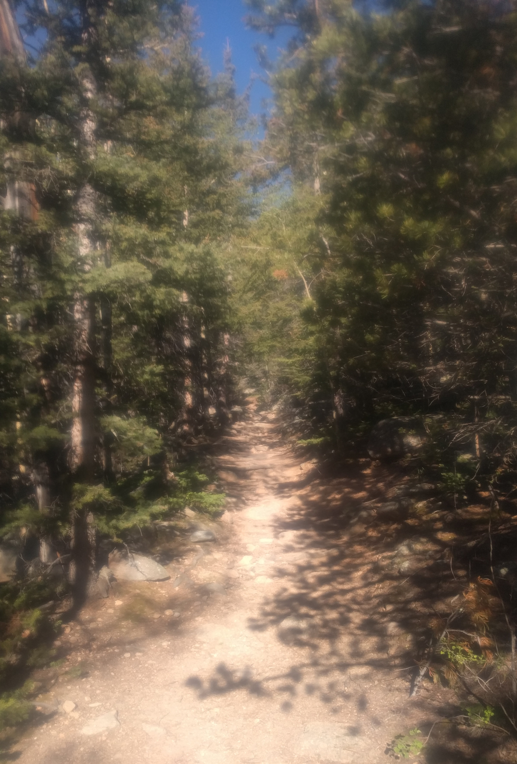
Easing up – after about 3-3.5 miles of steep climbing on The W’s the trail levels out a little and you can start to see glimpses of the summit through the trees. It still looks pretty far away – because it is about 8 miles out and another mile up.<
More middle section – the Trail continues to climb and when it turns certain ways you can see better views of the summit. Far fewer people were up on this section of the trail above the top of The Incline. I passed maybe 20-30 people in the first 3 miles or so and less than 5 people during the next 3 miles or so until Barr Camp at about the halfway point.
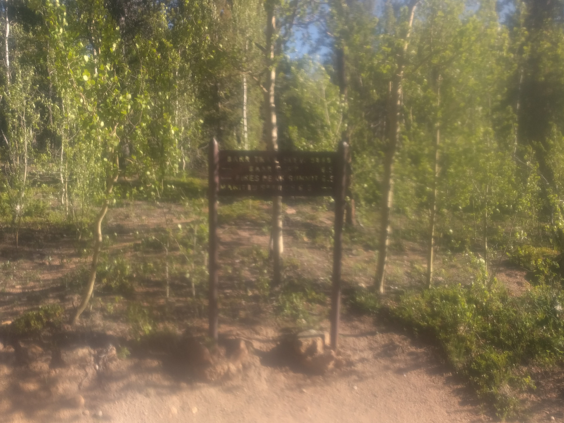
Blurry Sign – these signs were every few miles and I took a few pictures of them, this one didn’t come out so clear so I’m not exactly sure where it is, but about halfway to Barr Camp based on where it is in my pictures. The trail was pretty easy to follow up to this point and these signs are good for general location, but I’ve heard their info isn’t exact.
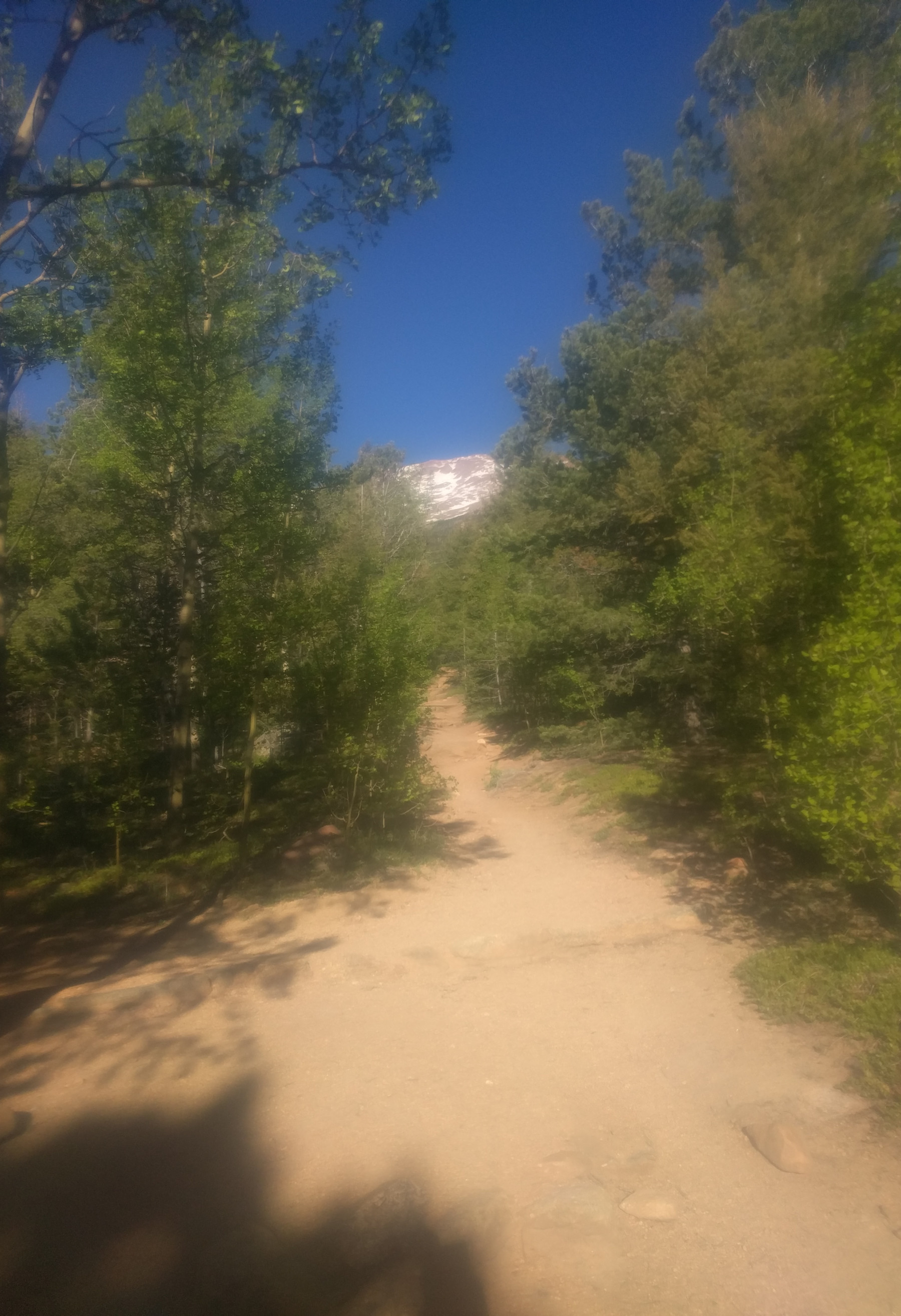
Another Summit View – even though this is the “easy” section of the trail it is still climbing, just on a gentler slope. I’m still below Barr Camp (the halfway point) here, making sure my HR stays low and taking it easy.
Climb to Barr Camp – the slope starts to get steeper again in the half mile before Barr Camp, but it’s so close you can almost smell the pancakes they are cooking.
 <
<
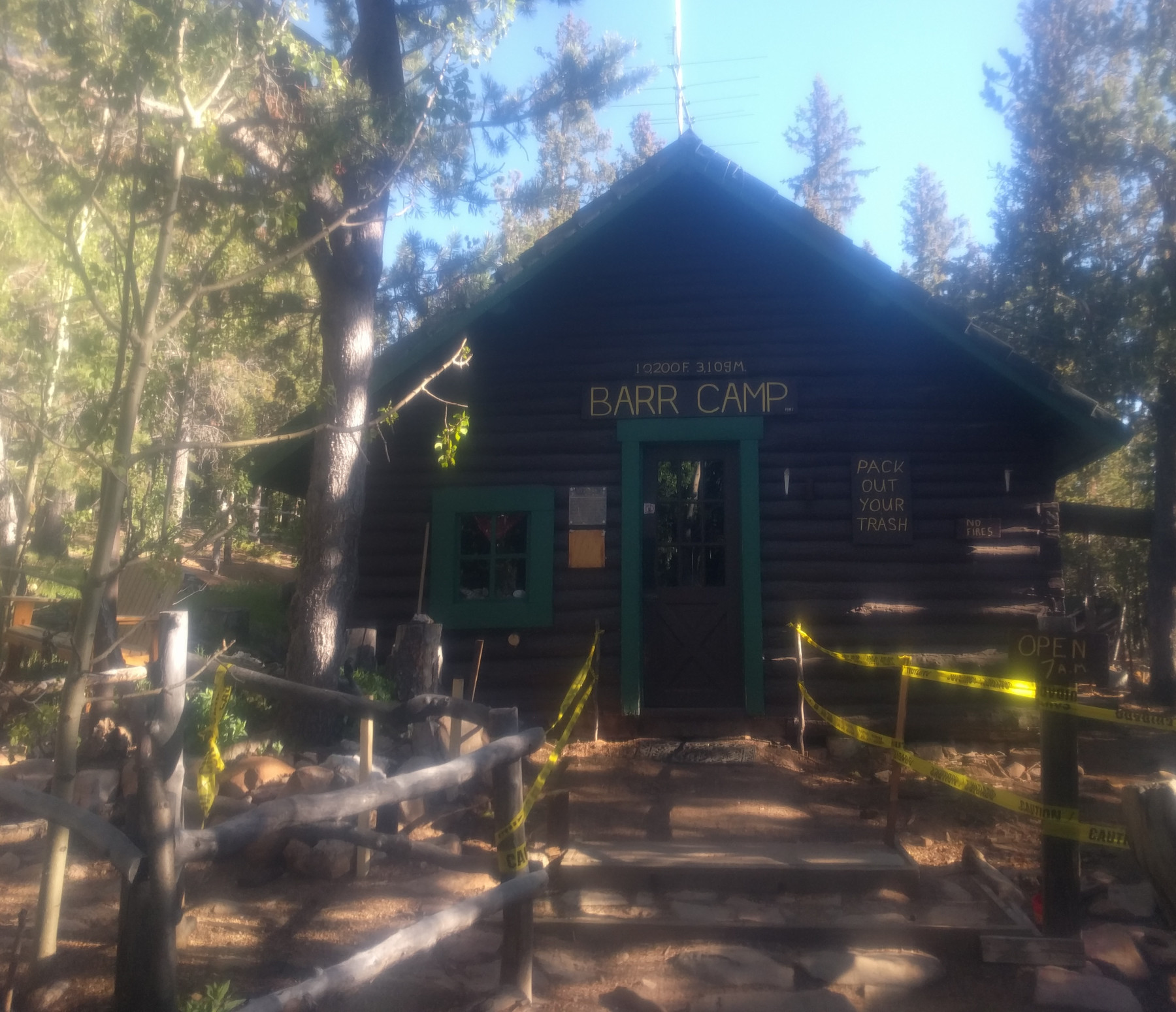
Barr Camp – halfway up the trail lies Barr Camp, a popular place to stay overnight for hikers making the climb in two days. At just over 10000ft in elevation it’s pretty high up there. I stopped inside and chatted about the summit (it’s snowy but melting) and they offered pancakes that were leftover from breakfast. It was about 1hr and 40mins into my run so I was way ahead of where I thought I’d be, and I was taking it pretty easy and keeping my HR way down. Up here the temperature was probably in the 50s but it felt good for running.
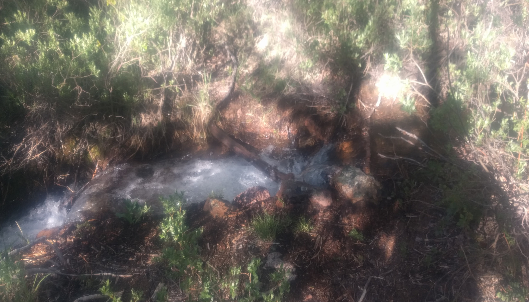
Stream Near Barr Camp – there is a stream to the left of the trail after Barr Camp where I filled my water filter bottle and walked for about 5-10 mins while I ate a cliff bar and finished off the water. I was pretty far ahead of schedule and still feeling great but figured I would take a break just in case I was missing something. This is the only time I felt cold, well my hand did after dipping it in the water to fill the bottle. The water tasted amazing and pure and was cold as ice.

Back to the Steep Inclines – quickly after Barr Camp the trail starts climbing aggressively again. I didn’t run into too many people after Barr Camp, I saw one person who was coming down, and four going up.

Pictures don’t do it justice – there were fewer places for pictures on this section of the trail, and the pictures I did take didn’t come out so well and certainly don’t do it justice.
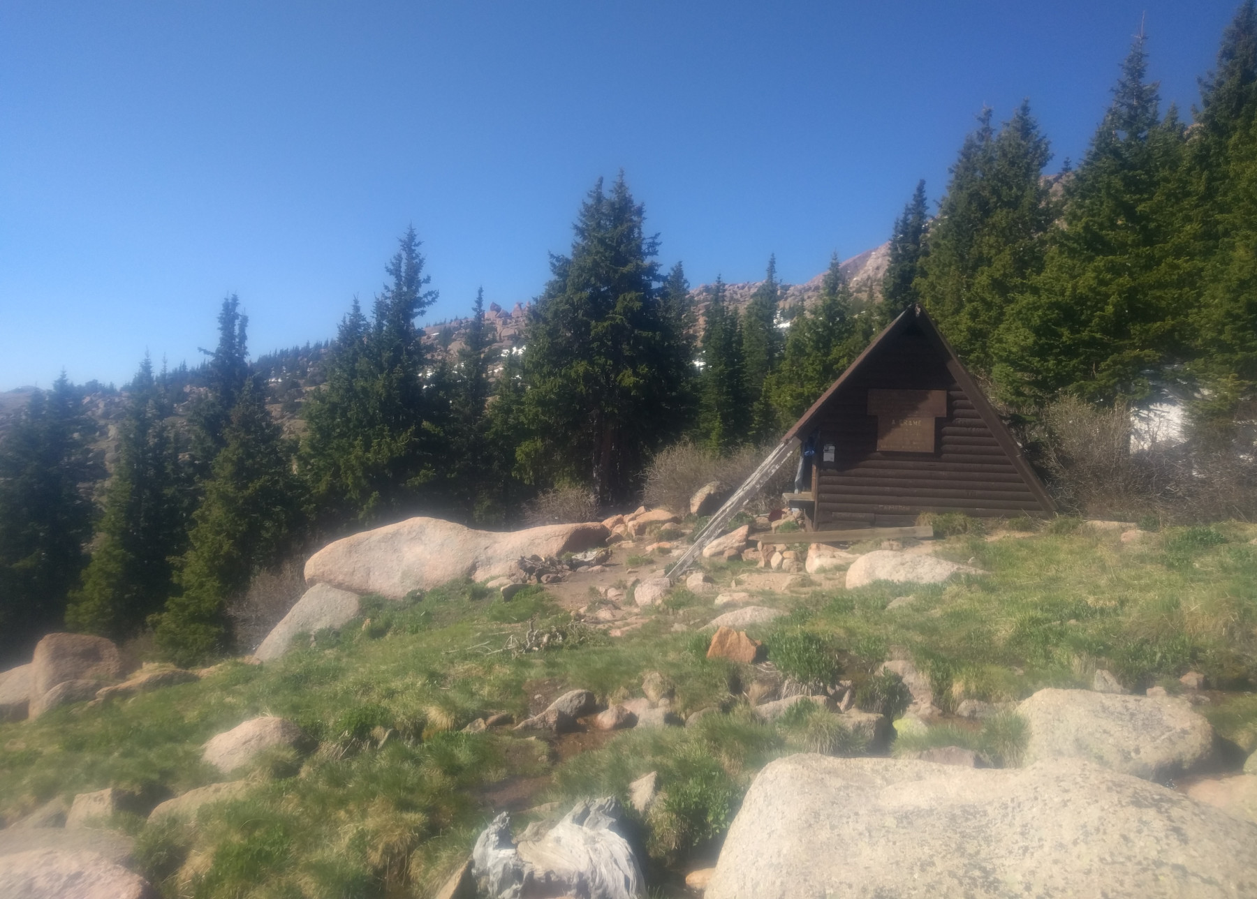
Another Summit View – you can still see the summit at times, but this part of the trail offers fewer views than earlier, and it still seems pretty far off. I didn’t really think about reaching the summit, just kept my eyes on the trail and a lookout for the next landmark which was the A-frame, a shelter about halfway between Barr Camp and the summit.
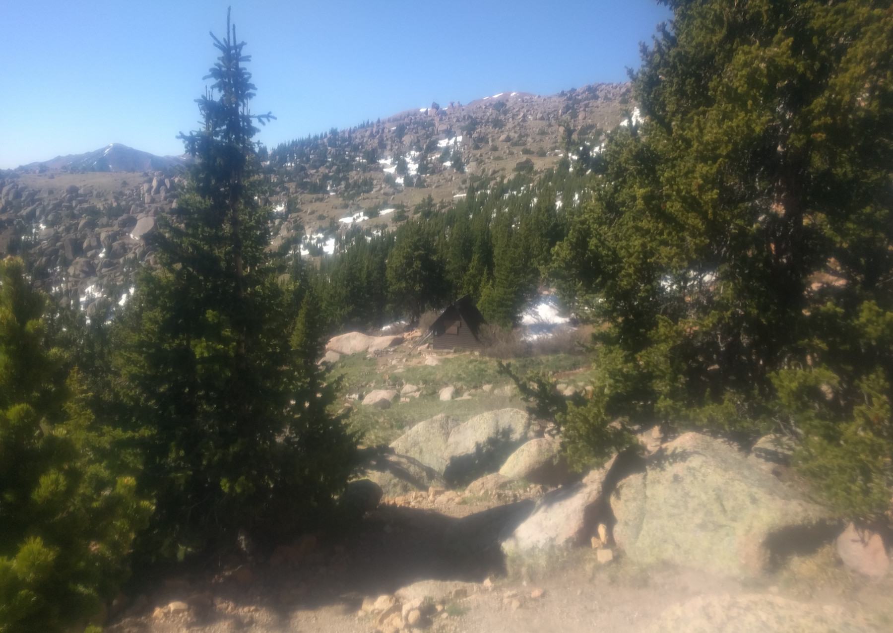
The A-frame – here is a view of the A-frame from the trail, it’s a bit hard to spot but it’s in the middle of the clearing below. It’d be a nice place to stop or take shelter if the weather turned, but other than the temperature dropping and the wind picking up the weather was great – barely a cloud in the sky. The wind did surprise me at times, coming over a ridge or out from the trees and you get hit with a big gust.

View from A-frame – here is a partial view from the A-frame, something you might wake up to if you spent the night 3/4 of the way to the summit. Again, pictures don’t really capture it.
A-frame – there is a small stream next to the A-frame where I refilled my water filter bottle. I made sure to drink plenty of water – one of the side effects of elevation is dehydration. I had 2 liters in my hydration pack and my .6L water filter bottle.

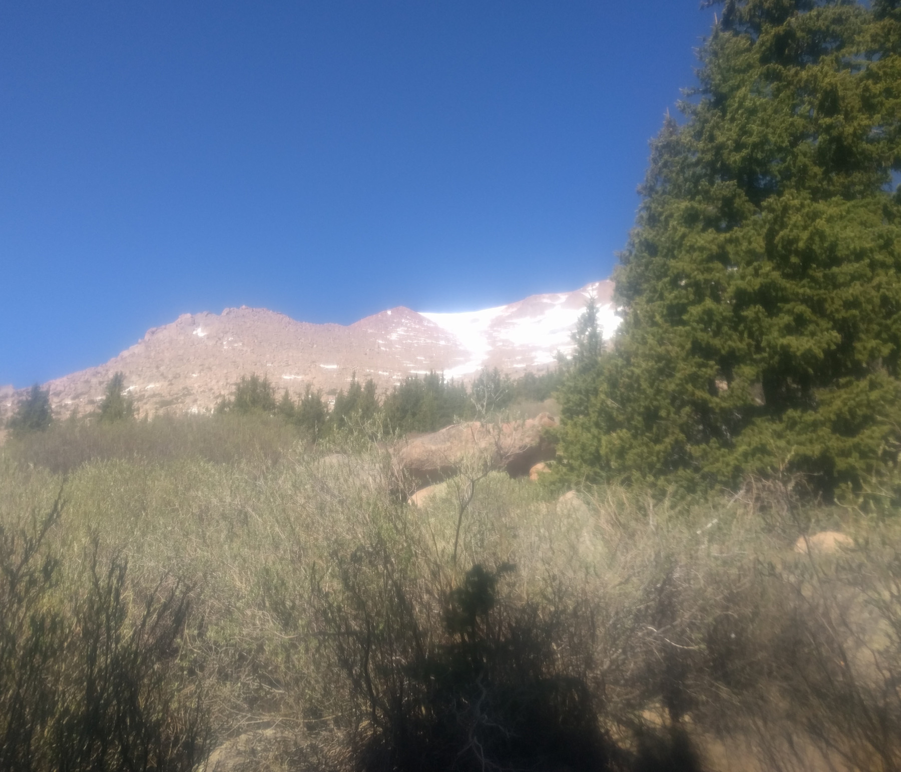
A-frame View of Summit – here is a view of the summit from the clearing where the A-frame is located. It still didn’t hit me that I’d have to climb through the snow, even though I saw it up there and the people at Barr Camp told me I would.

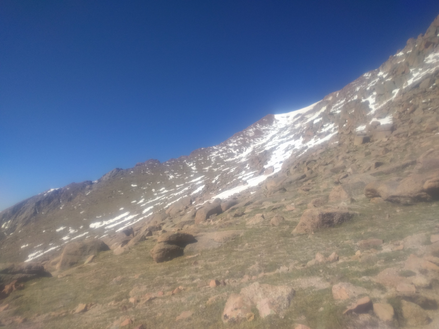
Another Summit View – just below the tree line (about 11000ft), when I got here I was thinking I’m almost done, and making great time. I still felt great too, not really feeling the effects of the altitude or the run which I kept pretty easy.

A Bit Closer – here is the real end of the trees. By this point I had run past occasional patches of snow on the trail that were in the shade and only one deeper than ankle height.
 <
<
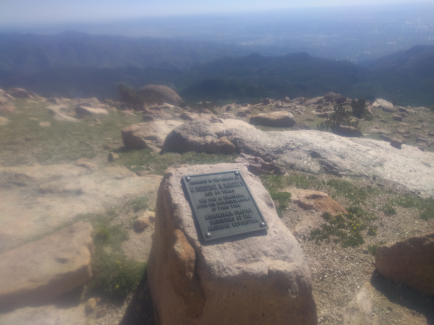
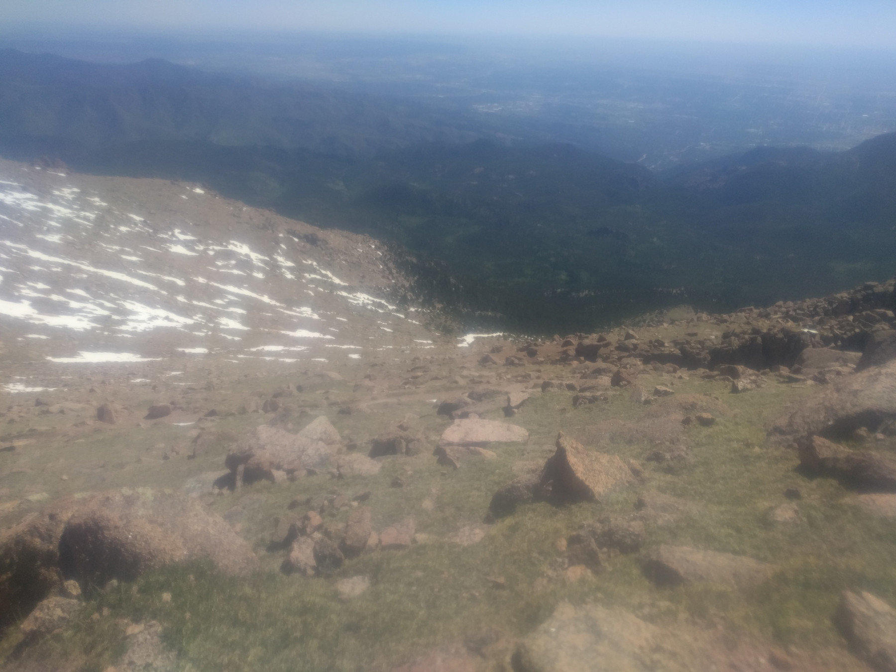
G. Inestine B. Roberts Memorial – with about 2.5 miles to go you pass a plaque in memory of G. Inestine B. Roberts who died in 1957 during her 14th ascent at the age of 87. Without the trees it really offers spectacular views.

View – pretty much any where you look is an amazing view. The pictures, especially from inside a bag, do not compare.
Summit Looms – the summit becomes more tangible when there aren’t any more trees between you and the top. It still seems pretty far off, something to worry about later, after all finding the trail is hard enough at this point because there are no borders to it, not trees or brush to mark the edges, only rocks, and maybe those rocks are a switchback, maybe not, maybe I need more oxygen.
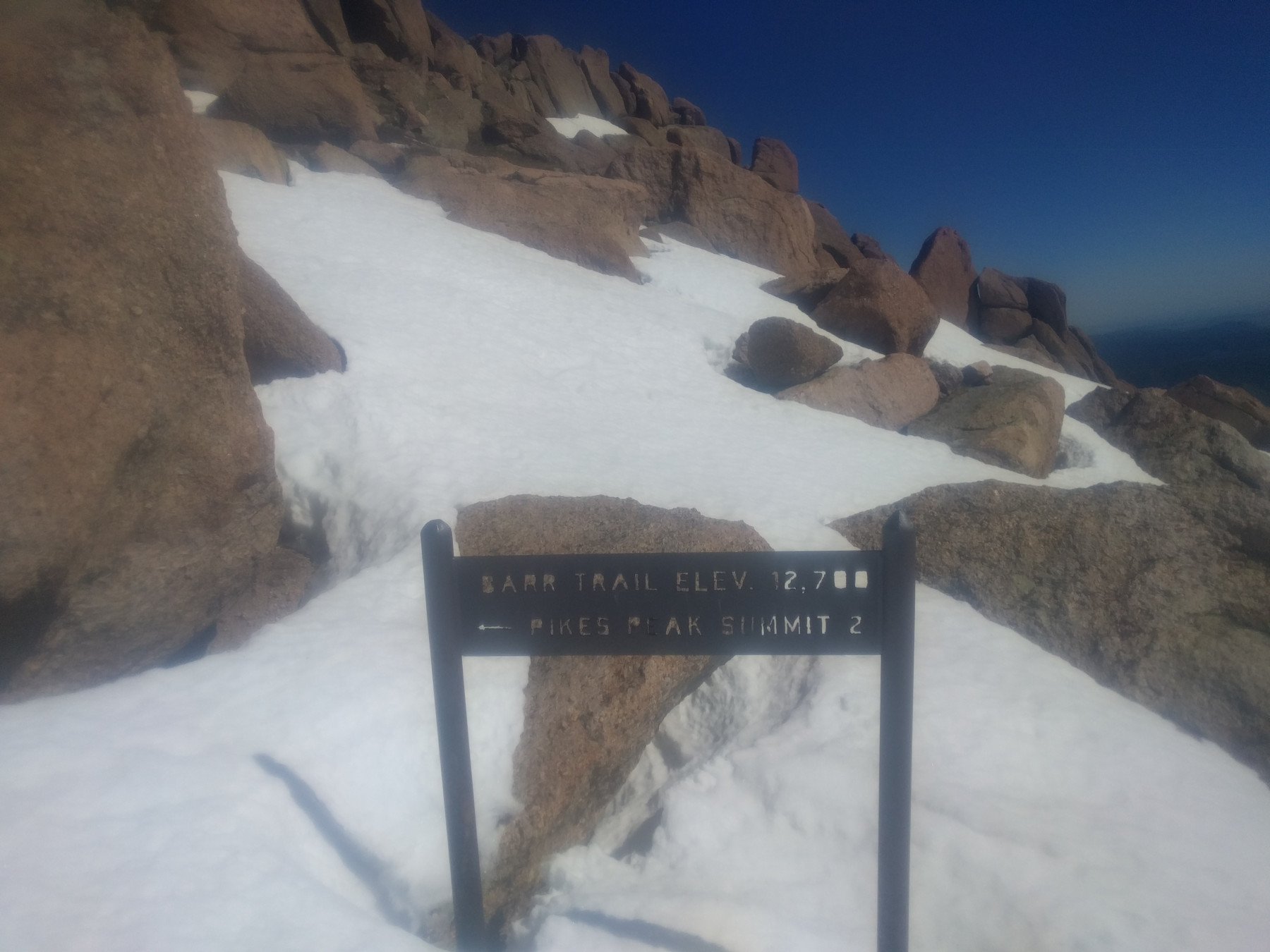
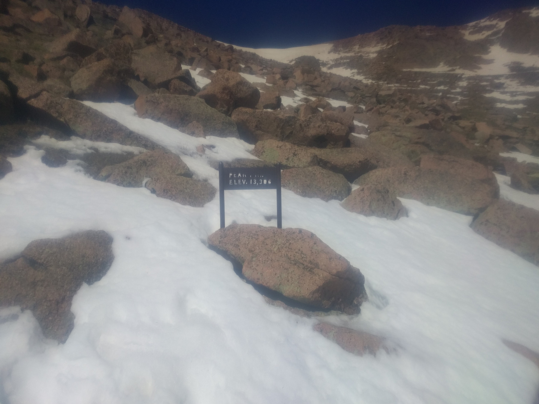
2 to go – with 2 miles to go there is a sign informing you how close you are. By this point the snow is pretty much covering the trail and I followed the footsteps in the snow, which had melted and froze many times so it wasn’t easy to run/walk on. Some footsteps went knee deep into the snow, some barely broke the surface, but the snow didn’t give, it was still pretty hard frozen.
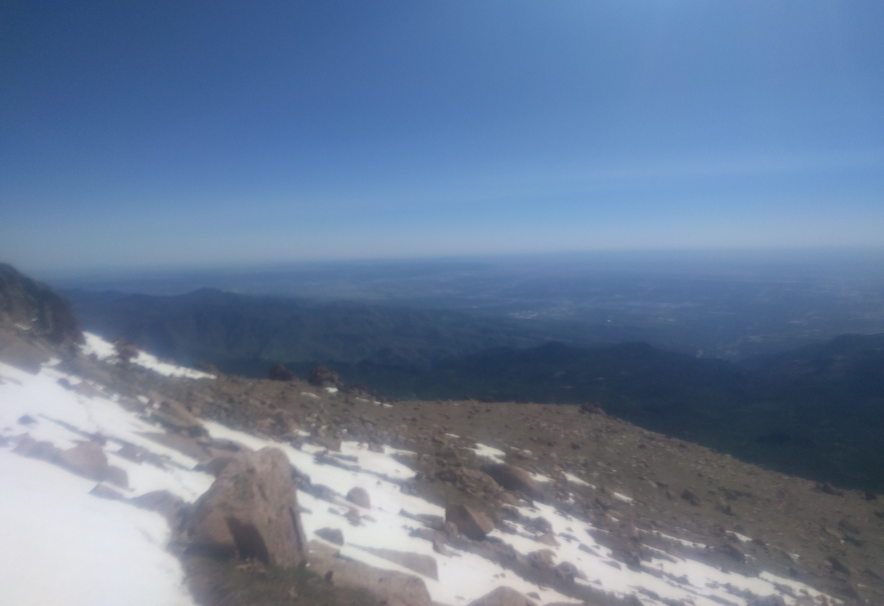
Exposed – you are really exposed at this point, to the sun, the wind, everything. It also is fairly steep with no barriers natural or otherwise to mark the stretches between switchbacks. A fall here could go down quite a ways, and there is still close to 1000ft of climbing to do – roughly the same amount I did in my hill workouts. I was still making pretty good time, HR was still low, breathing was good, but I started to feel a bit like the slope was getting to me.
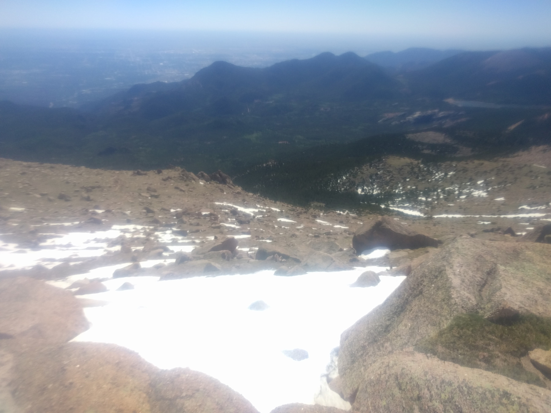
View – another view. I averaged about 15-17 mins/mile up to 2 miles to go so I kept waiting for the 1 mile to go sign, 15mins pass I don’t find it, then 20mins, hmm I must be close, 25, maybe I passed it and didn’t see it? 30 and I start to think I missed it, but still seem to have a long way to go. Something to think about at another time, just keep climbing.

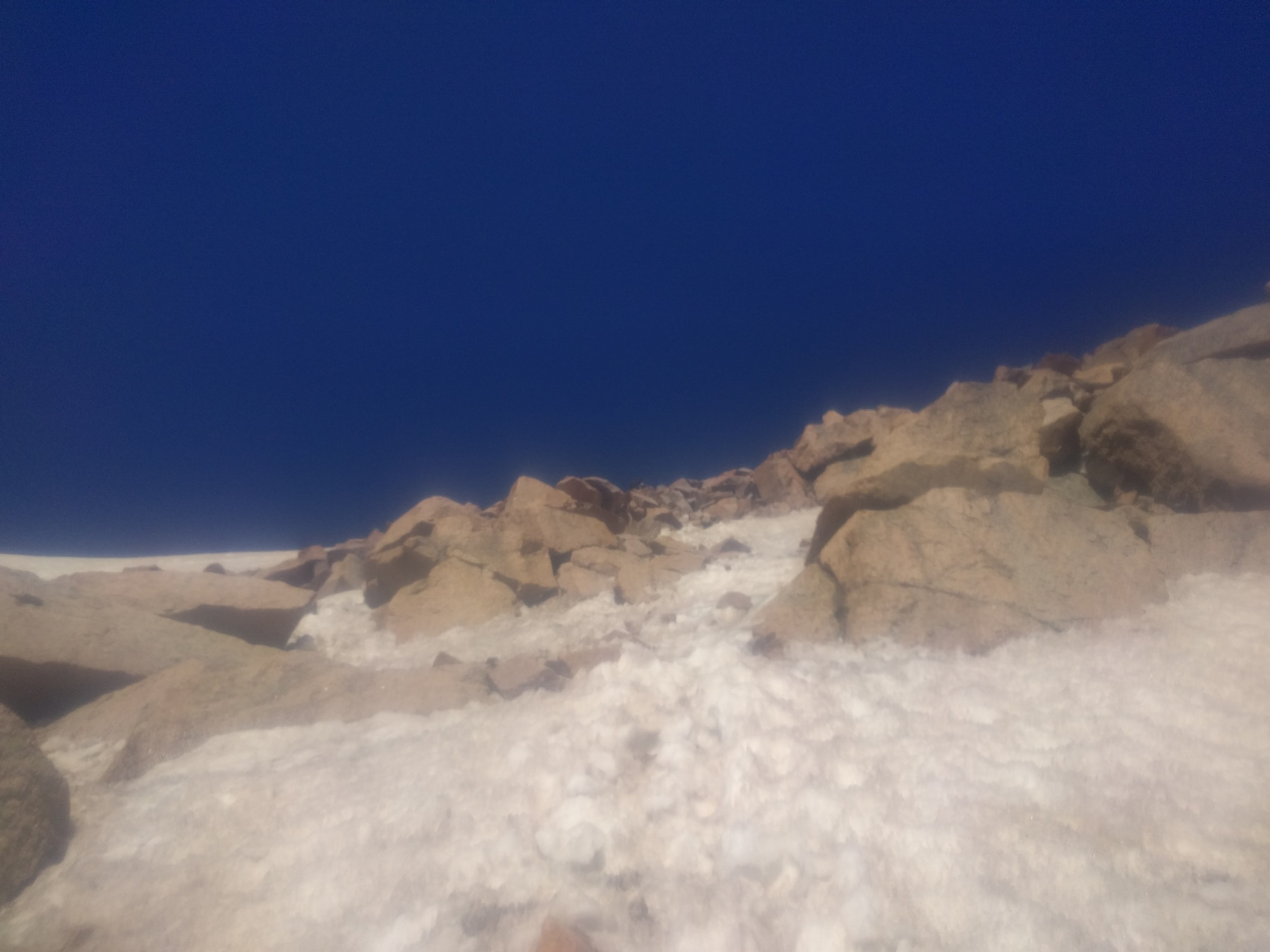
Paths in the Snow – you can see the paths in the snow here, which one is the right way? I don’t know, I follow the one I think is easier.
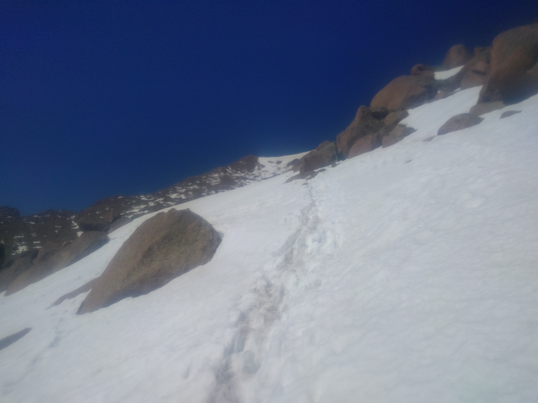
Paths – sometimes the easier looking path becomes harder to follow. I often resort to scrambling up on all fours through parts of the trail at this point.
1 to go – you can’t read it very well, but here is the 1 mile to go sign. Oh there’s the sign. I’m going much slower now, closer to 45mins/mile. The snow is hard to traverse. Even though it is in the 40s I’m still pretty comfortable in my shorts and t-shirt, short stints of running help keep me warm.
Looking Down – I leaned pretty hard to the mountain just to make sure if I fell I’d fall into it rather than off of it. I’m getting pretty tired of trying to find the trail by this point, and soon pass the “16 Golden Stairs” sign, which marks the last and hardest part of the trail. I lost the trail by the 2nd or 3rd stair.
Final Climb – I couldn’t find the actual path, but plenty of footsteps went up so I decided to take one more picture, and then follow them. It was pretty rough through this last part, alternating between the snow and the rocks on all fours, I never did find the trail again, but I did make it to the top.

On the Peak – I scraped my ankle sometime during the climb, but I made it to the top and it was windy. That was my first impression, well after relief, it was very windy so I got down behind a small wall and put on my long pants and long shirt. It was still cold though. I felt great, I made it to the top, I felt like screaming from the top of a mountain – and I was on top of a mountain! But I was in no mood for screaming. I admired the views for a moment or two and then headed inside.
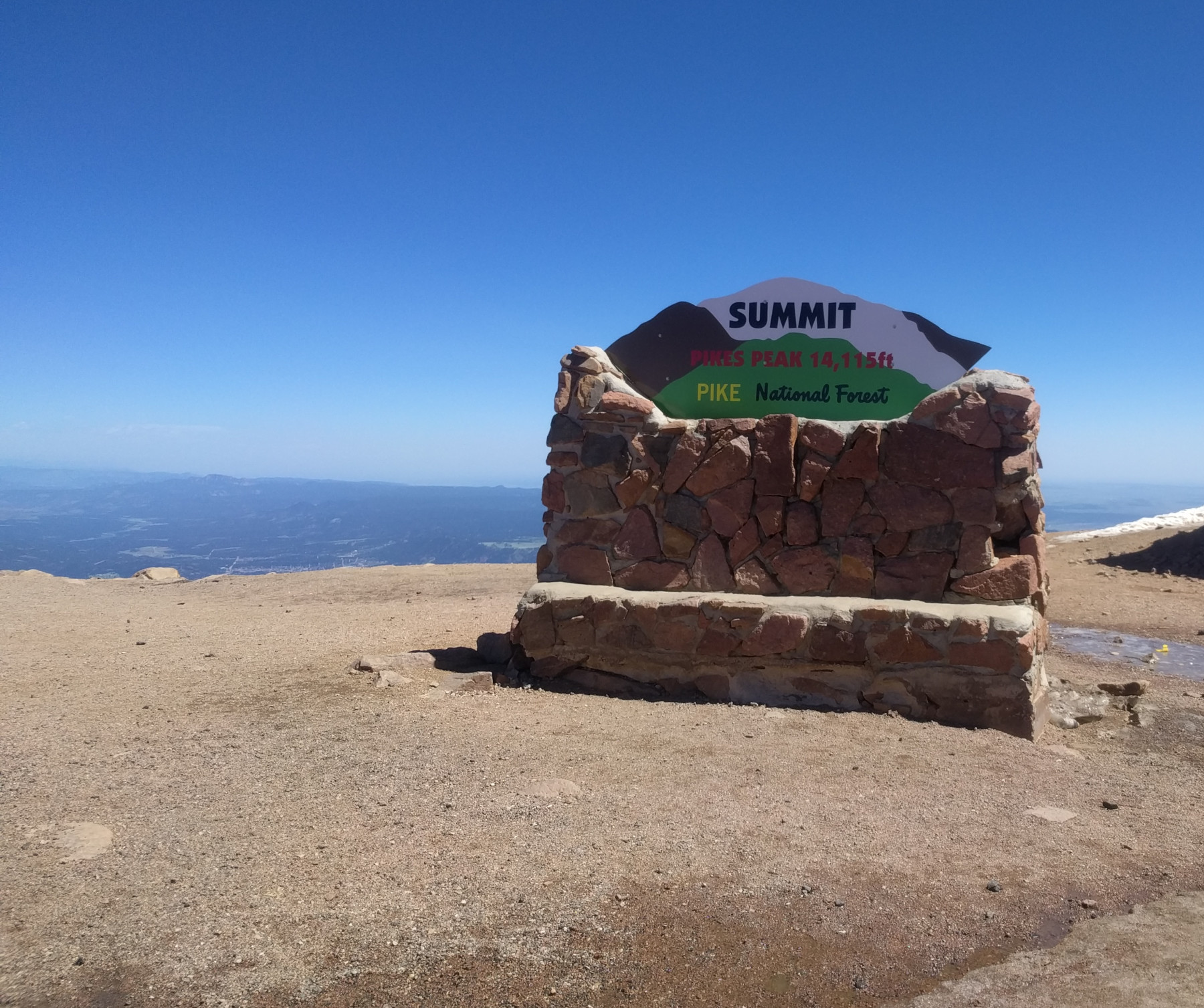
Summit – Then I remembered I should take at least take some pictures. Here I finally have my phone out of the bag and the picture looks so clear.

Summit -the summit is kinda a large flat area on top with a parking lot, a gift shop and some viewing platforms. The elevation and run were starting to get to me, feeling a little light headed and getting a bit dizzy and sick feeling. Still had plenty of water so I continued to drink that.
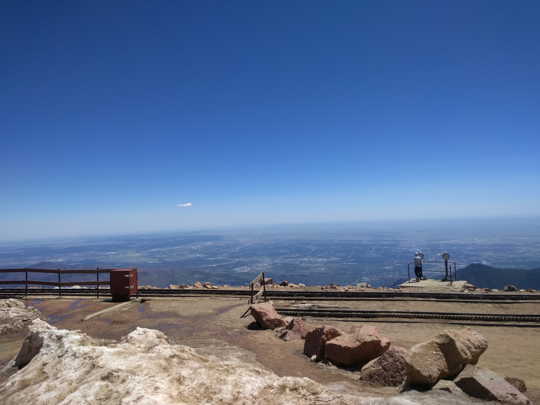
Summit – The wind was really strong up here.
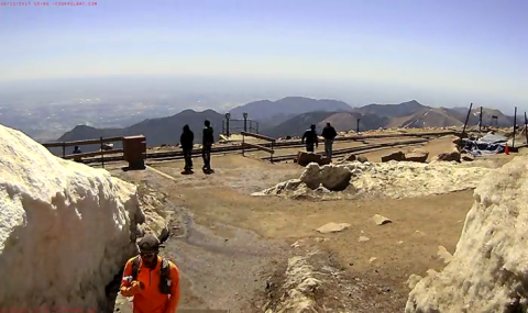
Cog Railway Webcam – The Cog Railway has a webcam that takes a picture once a minute and the next day you can see a time lapse video which I happen to be in (in the orange). I made the summit off to the right of this picture across the railway tracks.

Closer – a closer view of me from the Cog Railway Webcam.
The Data
The following is more data oriented gathered from my watch on the way up.
Distance: 11.32 miles
Duration: 4:26:28 (or 3:29:07 moving time from Strava)
Elevation gain: 7382ft (1.39 miles)
HR avg: 147 bpm (on average easy runs I average about 160)
Calories burned: 3405
Daily Activity: 668% (my HR watch gives a daily activity goal of around an hour of activity, which it measures based on HR or something, usually an hour swim will put me about 150%, a long run will put me in the 200% range and a 4hr bike ride about 250%)
Elevation Gain by mile:
| Mile | Elevation Gain | Grade |
|---|---|---|
| 1 | 691ft | 13% |
| 2 | 772ft | 14.6% |
| 3 | 601ft | 11.3% |
| 4 | 545ft | 10.3% |
| 5 | 256ft | 4.8% |
| 6 | 475ft | 8.9% |
| 7 | 605ft | 11.5% |
| 8 | 772ft | 14.6% |
| 9 | 716ft | 13.6% |
| 10 | 696ft | 13.2% |
| 11 | 731ft | 13.8% |
| 11-11.3 | 537ft | 33.9% |
As you can see the first 3 miles are pretty steep and then it levels out in the middle a bit, then climbs again towards the end. The last .3 miles is when I pretty much eschewed the trail and went straight up.
Here’s a quick reminder of what my hill workouts were in preparation for the climb:
Hill Repeats – note the scale on the left, where I don’t travel above 200ft at all.
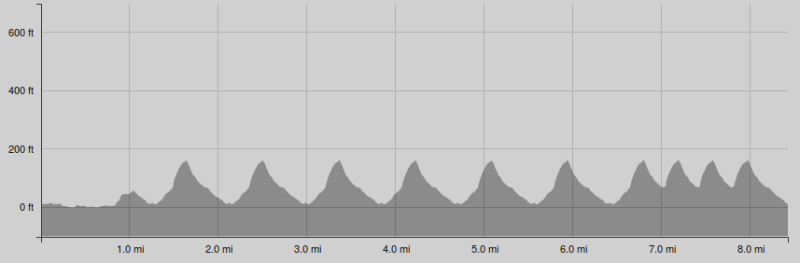
Here’s the elevation from the climb:

Pikes Peak – The black line just barely above the horizontal scale, visible in the first mile towards the bottom left represents 200ft. Each larger section on the vertical scale is 2000ft, over 10x more than I climbed in any hill repeat section in any of my training. Let that sink in again, the whole vertical scale of my hill repeats would fit between the bottom line and that small black line in the graph above. Surprisingly I didn’t have any problems climbing, my legs felt great and there was no burning quads or anything.
GPS Data:
These next images are from GPS data.
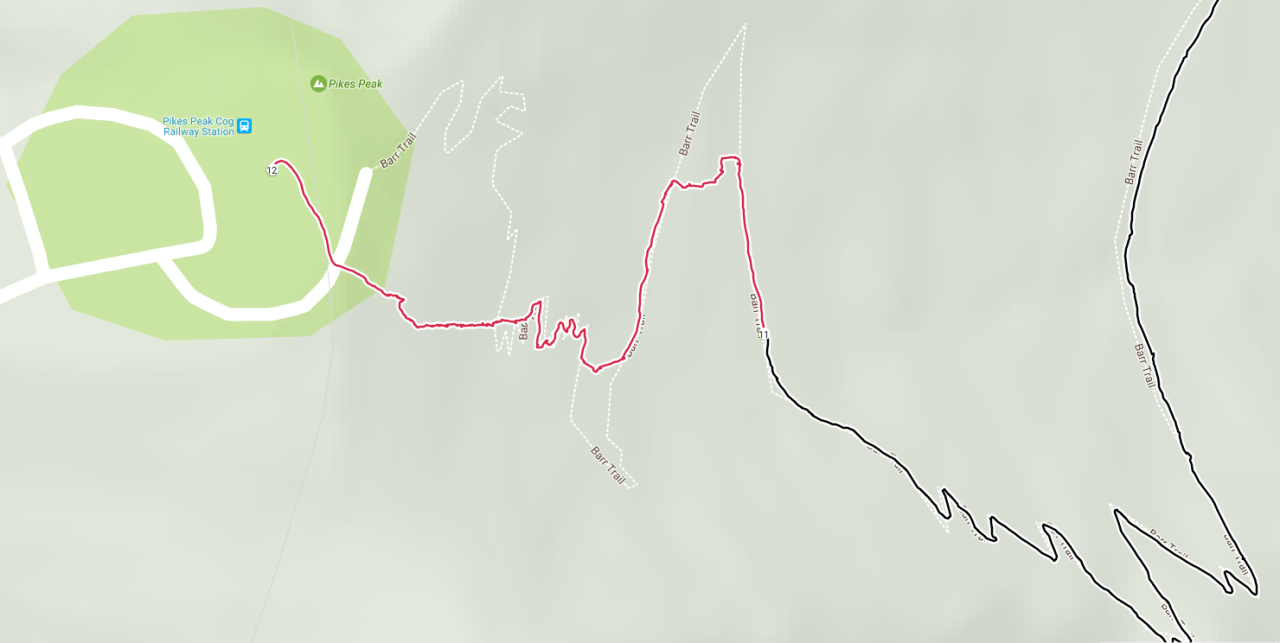
Last bit – here you can see the black and red line representing my path and the white representing the trail. The black part to red marks 11miles and you can see after that I sort of stayed on the trail for a little bit, then just went straight up.
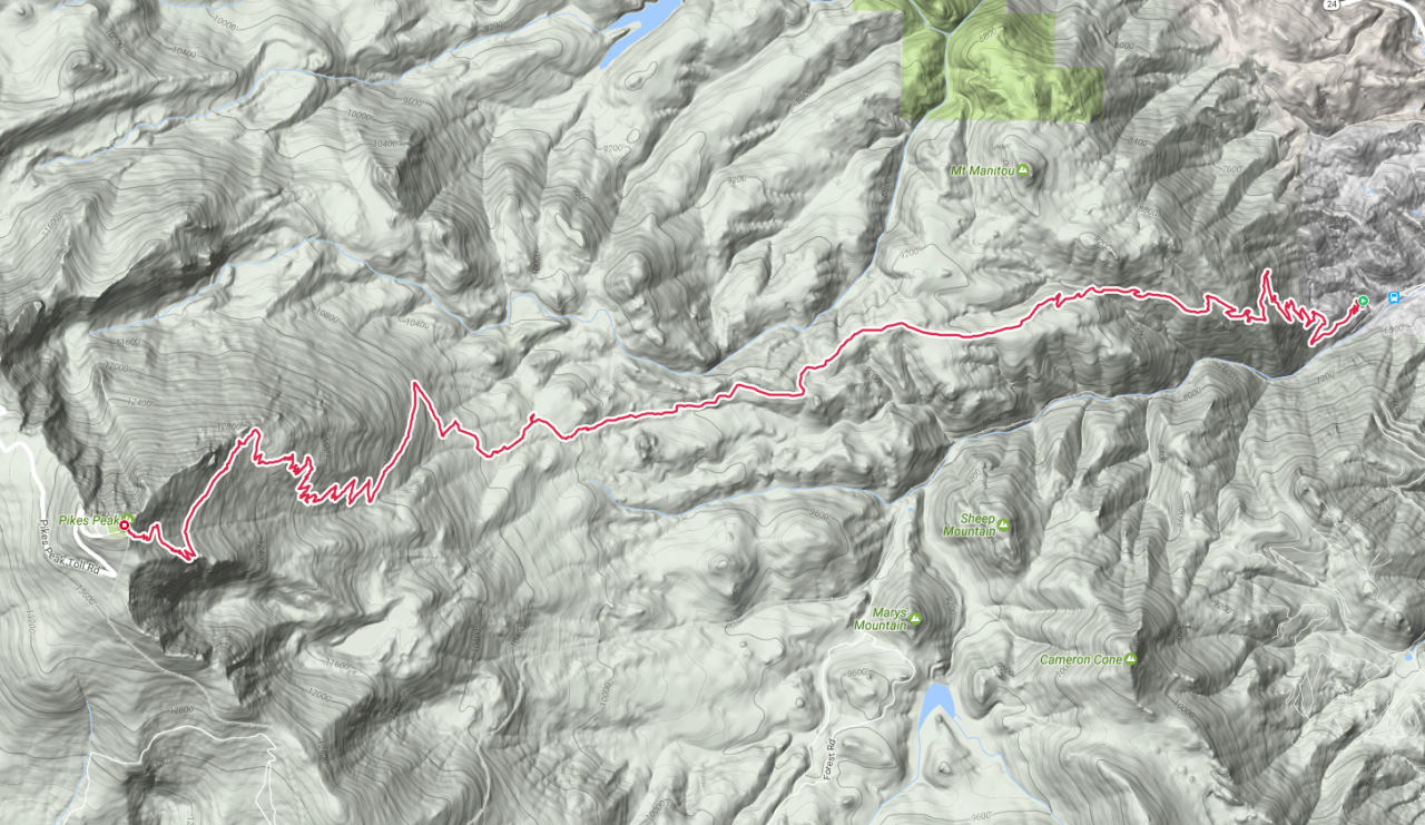
Barr Trail -The whole GPS trail my watch recorded against a topographic map of the area.
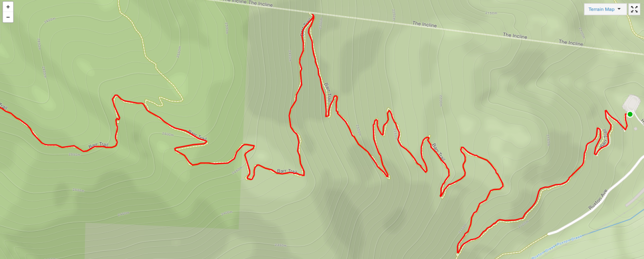
The W’s – The first section of the trail, so named because it looks like W’s. Sort of. Maybe if you just ran up to 14000ft and tried to write a bunch of W’s…
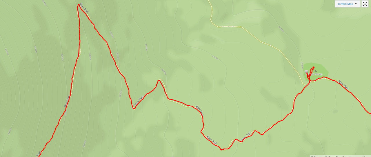
Barr Camp – here you can see where I stopped off at Barr Camp. Also note how closely I was able to stay on the trail when it was marked and surrounded by trees.

A-frame – the bottom towards the middle left you can see where I jumped off the trail to see the A-frame.
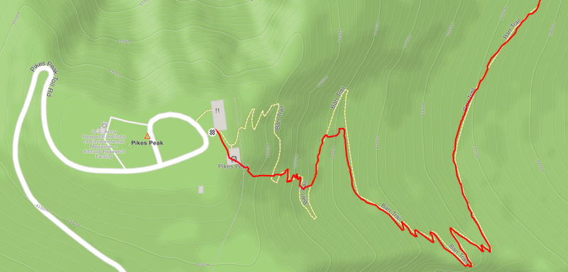
Summit – here’s another view of my summit approach. Skipped a few switch backs.
Notes for next time:
My preparation was rather well I think, my legs didn’t hurt more than a typical long run. The elevation got to me towards the end, but there’s no real way to prepare for that other than elevation, and my options were limited. I had plenty of water, my nutrition was good, my HR stayed low. The only thing I’d change is to do it at a different time when there isn’t any snow up top. I think the snow makes for better pictures, but it was really a pain to climb through. Those last 2 miles took me about 1.5hrs when the 9 miles before that took about 3hrs. I’d like to do the race (they hold it in August when usually no snow is up there) but I’d also like to do it and bring my own water and everything again.